this post was submitted on 24 Feb 2025
157 points (97.6% liked)
Cartography Anarchy
1229 readers
86 users here now
A community for Cartographers with nothing left to lose.
Rules:
Don't be awful Lemmy Guidelines Still Apply.
No direct upload images This is hosted on Lemm.ee- to post images, you must use an image upload service like Imgur to post maps.
We are agents of chaos I've created this to be the alternative to the community I used to manage on the website that shalt not be named "mapporncirclejerk"
Live and let die Meme trends happen, so please don't message mods asking to take down maps that are repetitive to a bit.
Reposts Vs. Covers Not all reposts are evil- if someone posts something that has been done years ago, it serves to bring old memes to the new users. I call these meme covers. However it can be done in excess which makes it a repost and spam. Mods will determine if a post is a cover or a repost.
No impersonating mods I can't believe I had to make this rule.
No harassing mods on an appeal We can talk it out, and we will be acting in good faith when making decisions. If you disagree with a removal, you are free to message for clarification or to appeal by giving some added context.
Bans Bans will be set to a maximum of 365 days for humans, and a minimum of 365 years for bots. I believe people can change, so if you are banned for good reason, do know that it is not permanent, it is just a way to say "take time to grow and come back when you are ready".
founded 1 year ago
MODERATORS
you are viewing a single comment's thread
view the rest of the comments
view the rest of the comments
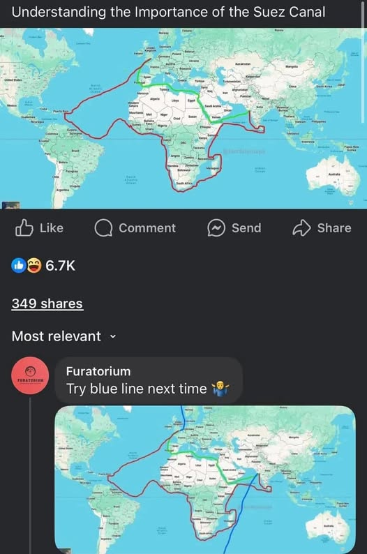
I have no idea about shipping routes or ships in general. But why the detour to Puerto Rico? Why that stupid ass tilt to the north when going to Africa? Why go around the eastern coast of Madagascar instead of along the western coast? Does this shit even make sense?!
I would suppose that it's showing an actual trade route that was frequently taken. First stop Caribbean to pick up sugar or something, salt in West Africa, Eastern Coast of Madagascar perhaps has more developed trade than on the west coast. Not the shortest route being depicted here but perhaps the highest value trade route.
They wouldn't unless they were picking up trade. All the maps showing the cape route show them sticking to the coast of Africa
I think the detour to Caribbean does make sense if you're on a sailing ship. You want the most downwind route, not necessarily the shortest route. I think that detour skirts around the typical Azores high, which is associated with very low wind speeds.
I don't know about the east coast of Madagascar. But one theory is it might be like Florida: Between Florida and the Bahamas, there's a quite strong northbound current, so southbound sailing vessels will swing way out east of the Bahamas.
Isn't that the Bermuda's triangle? Scary stuff happens there, let me tell you.
How does the green line explain the red line's detour to the Caribbean or the loop around Sri Lanka?